meet.barcelona
Visit and love it
Canal de la Infanta
Download date: 18/12/2025

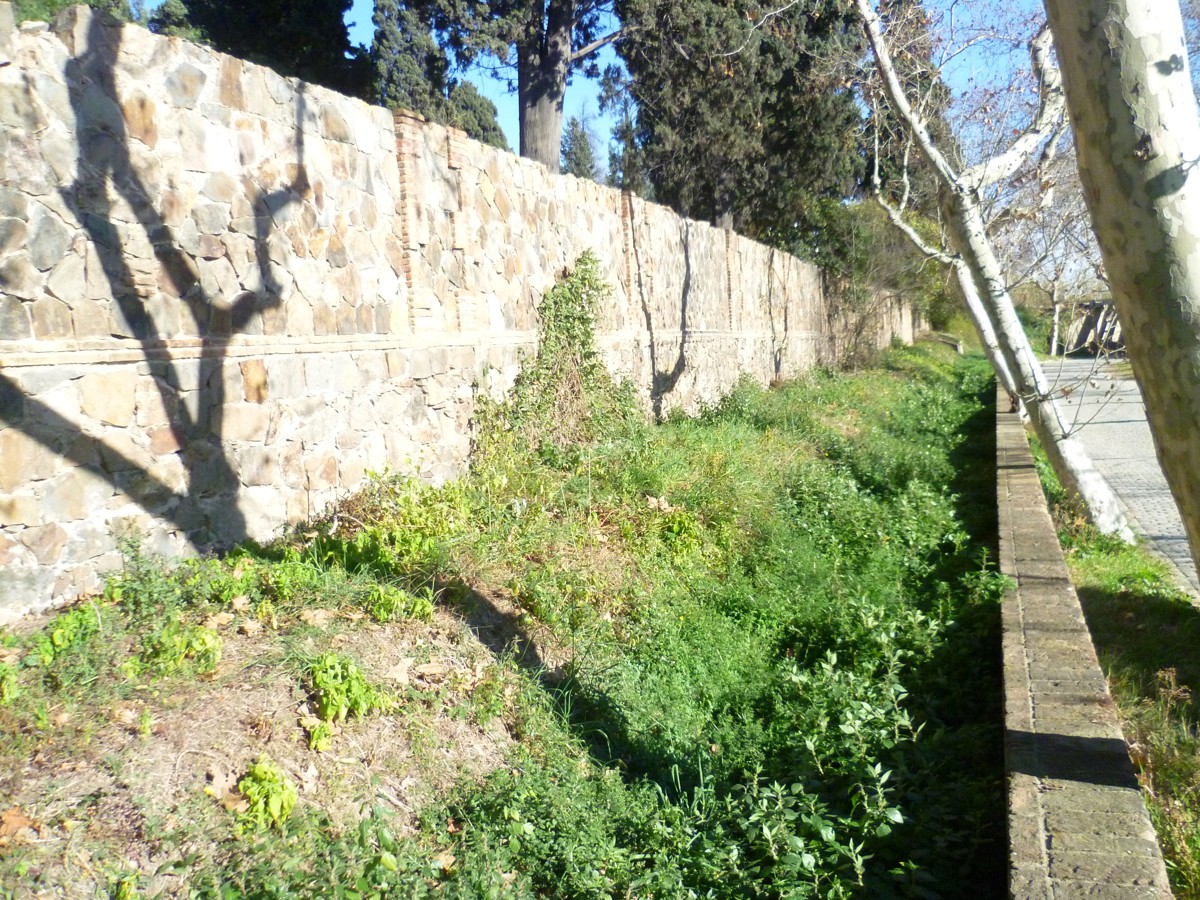
The construction of the Canal de la Infanta totally transformed the Baix Llobregat area, by providing irrigation for over 3,000 hectares of land.
-

Cultural heritage
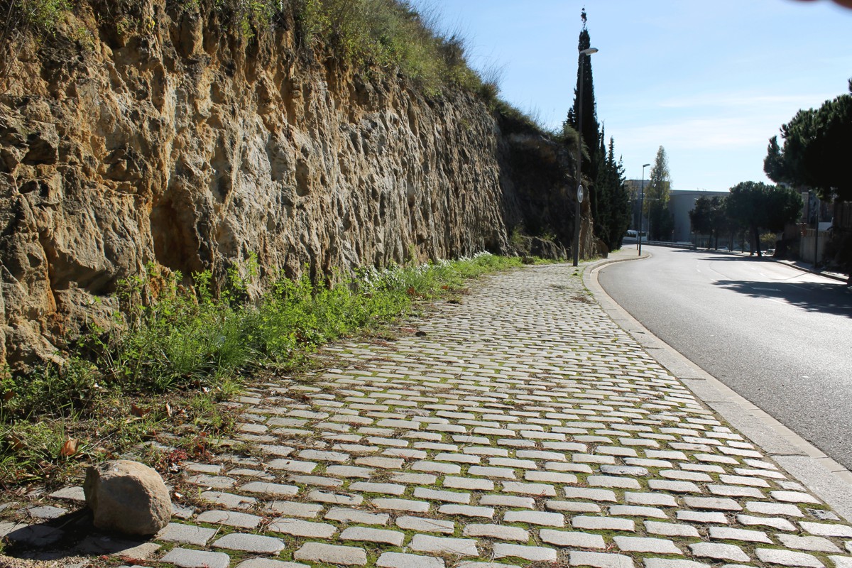
Standing in this corner – where the cobblestones, railway bridge and lines of plane trees follow the layout of the old road to the Port, still conserved, right up against the wall of the cemetery – is a visible section of the great water transport system known as the Canal de la Infanta. It was designed by the engineer and surveyor Tomàs Soler i Ferrer to irrigate and enrich the fields of the Baix Llobregat. Work began in 1817 and was completed in 1820. Initially called Canal de Castaños, it was renamed Canal de la Infanta Carlota in 1824. The channel was a 17 kilometre-long ditch, reinforced by brick walls, that ran from Molins de Rei, where the sluice gates were located, to the sea. Work involved constructing bridges, siphons and waterfalls that were put to industrial use, as were the windmills. The channel crossed the Marina along what is now Mare de Déu de Port Street.
 :
:
Location and contact
Location and contact


Canal de la Infanta
- Address:
- C Mare de Déu de Port, 56
- Districte:
- Sants-Montjuïc
- Neighborhood:
- el Poble-sec
- City:
- Barcelona
Observacions
Discover other related points of interest
-
Pedrera Romana
C Ferrocarrils Catalans 4
-
Plus Ultra housing estate
C Aviador Ruiz de Alda 28
-
Torre Calatrava
Pg Minici Natal 8